North Kyoto Cycling Route – Rider Stories
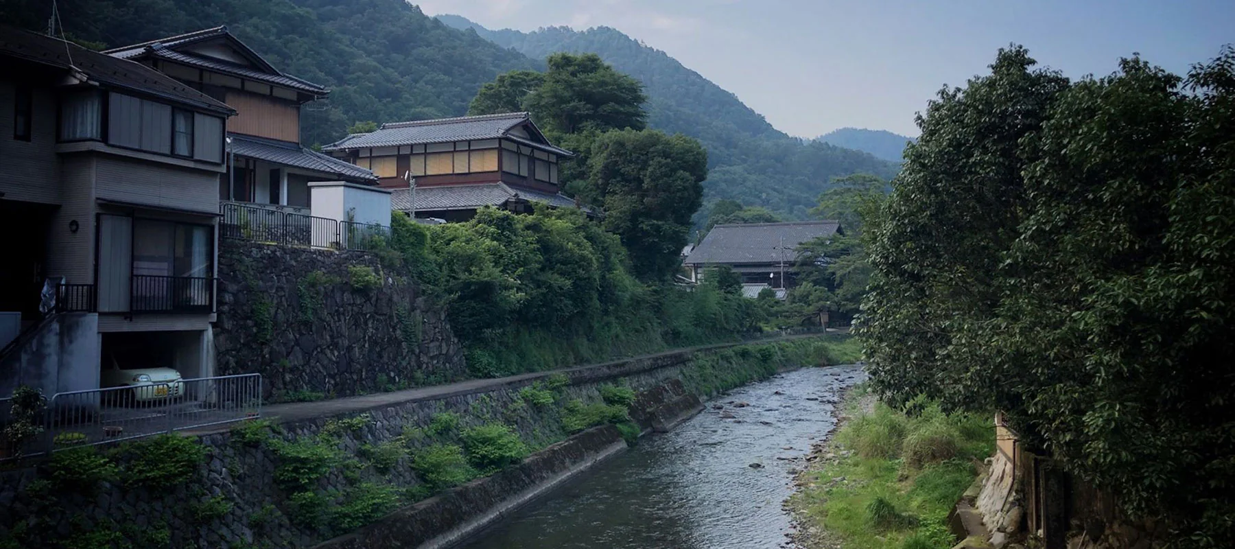
The mountains in the north of Kyoto are special – giant cedar trees, picturesque Japanese houses and farms, rivers and streams flowing from town to town and mountains with almost endless winding roads.
撮影:ジュゼッペ・シアオラ
ルート
40kmという距離は長すぎず、トレーニングに充分適していると言えるでしょう。サイクリングは主に川沿いや、京都北部の郊外を通る山道です。
Distance: 40.27km
Elevation: 474m
Access from Kyoto city: Good (This is one variation on the North Kyoto Hills loop which can be extended upwards of 75km all started from RBRJ Kyoto’s location)
今回のサイクリスト

#RideNowRaceTeam
Giuseppe lives in Shanghai where he is an active member of the growing cycling community in China. When he travels he loves getting out on the bike, attacking the local surroundings and capturing parts of it with breathtaking photos. Most of the photos in this blog were taken by Giuseppe and we thank him for letting us share them with you.
Giuseppe went for two rides in Kansai and this is one of them. His other ride was an epic 140km loop down to Nara and back in searing summer temperatures.
We decided to feature his 40km ride because we think it offers so much for all levels of cyclists in Kyoto. Giuseppe had a bit of extra time in the afternoon so jumped on the bike, got his ride in and was back to enjoy his evening in beautiful Kyoto. We’re all short on time which is why we love Giuseppe’s route and we’re sure you will too.
使用した自転車

RBRJ now offers the Cannondale Optimo 1 as an updated option
鴨川スタート
このルートは、京都の街を北から南に流れる、有名な鴨川から始まります。川沿いには、素晴らしいサイクリングコースやジョギングコース、また丁寧に整備された庭園があり、自転車で探索するのに最高な川といえるでしょう。

京都の地元の人々もまた、普段から川縁の雰囲気と空間を愛でて、ジョギング、運動、サッカーなどを楽しんでいます。
ルートは三条駅から始まり、そこから北に向かいます。川が二つに分かれるまで進み続け、高野川に繋がる右側の道に入ります。

高野川から山の中へ
川に沿って宝ヶ池公園を通過し、宝ヶ池駅付近を右にカーブしていく川をたどります。

山や森に入る前に、町はずれを通り過ぎるでしょう。道路は徐々に標高が高くなり始め、自然の音・香り・景観に迎え入れられます。

山道には寺社仏閣が点在しているので、立ち寄って見るのもいいし、そのままペダルを漕いでバイクからの景色を楽しむのもいい。
大原野村町を左折
大原野村町に着くまで、高野川沿いの国道367号線を上り続け、それから国道40号線へ左折します。

大原野村町には、美しい景観と川沿いに立ち並ぶ伝統的な家屋があり、サイクリスト達を楽しませてくれます。

標高
国道40号線に入ると標高が増し始め、ここではエネルギーを燃やし、リズムにのってライドすることになります。この勾配は約2km続き、傾斜は9.7%に到達し、心臓と肺が間違いなくしっかりと働いてくれることになるでしょう。

After the peak of the small climb you’ll start descending down the winding road through the mountain.
市原駅を通過後、国道40号線は左に曲がりますが、ここでは、38号線へ変わる道へ直進していきましょう。

You’ll pass through an area called Shizuichiichiharacho as you make your way back towards the suburbs of Kyoto.

鴨川、上賀茂、フィニッシュ
It’s here you’ll link back onto the Kamo river as you head south towards Kamigamo and into the northern Kyoto suburbs. The north of Kyoto is a lovely place with lots greenery, mountains to the west, north and east, and also some great cafes to stop at for a coffee or a spot of lunch. The route will then turn left and head along the north side of the Kamigamo golf club as you make your way east to join back onto the Takano river that you started on.

高野川と鴨川沿いの終着点付近のライドを楽しんだら、その後このルートは京都中心地へ向かい、ゴールとなります。
まとめ
You won’t be disappointed taking your bike into the mountains north of Kyoto city. If you’re looking for a medium length ride with stunning scenery then we recommend trying Giuseppe’s route. He had a great couple of days riding around Kyoto (and Nara) and we appreciate him letting us share his route and photos on our blog. How about you? Do you have any favorite routes around Kyoto? We’d love to hear about your experiences cycling around Kyoto, the cultural capital of Japan.
